-
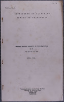 General Monthly Bulletin of the Statistics of Palestine, Vol. I, No. 1 (July, 1936)
-
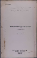 General Monthly Bulletin of the Statistics of Palestine, Vol. I, No. 3 (September, 1936)
-
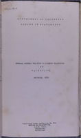 General Monthly Bulletin of the Statistics of Palestine, Vol. I, No. 6 (December, 1936)
-
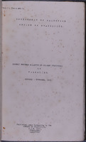 General Monthly Bulletin of the Statistics of Palestine, Vol. I, Nos. 4 and 5 (October - November 1936)
-
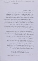 General Union of Palestine Students - UK
 A document issued by the UK branch of the General Union of Palestine Students, that refers to support for the PFLOAG and other causes
-
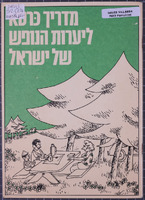 Guide to Israel's Holiday Forests
 32-page booklet, titled in Hebrew 'Madrikh karta le-yaʻarot ha-nofesh shel Yiśraʼel' [Guide to Israel's Holiday Forests ] containing forty maps of recreational forest walks and leisure sites. Published by the Agaf fa-Hasbarah [Information Department) of the Jewish National Fund.
-
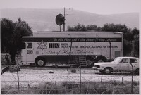 High Adventure Ministries mobile broadcasting station, Palestine, ca.1979-84.
 Black-and-white photograph of a large lorry parked in Palestine, with 'HBN High Adventure Broadcasting Network. Star of Hope Television' printed on the side, beneath the Biblical quotation "'In this Place will I Give Peace': Free Lebanon." High Adventure Ministries was founded by George Otis in the early 1970s, and later included a 'Voice of Hope' radio station and 'Star of Hope' television channel, working closely with the IDF, Saad Haddad and the Free Lebanon/South Lebanon Army, a Christian militia group operating in the Israeli-supported 'State of Free Lebanon.'
-
 Israeli Land and Settlement Policies
-
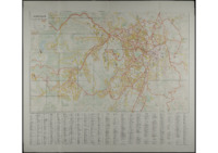 Jerusalem Street Map, 1968.
 Jerusalem Street Map, Compiled, Drawn & Printed by Survey of Israel, December 1968.
-
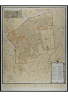 Jerusalem, The Old City, 1:2500. 1975.
 Jerusalem, The Old City, 1:2500, First Edition prepared by F.J.Salmon, 1936. Revised and printed by the Survey of Israel, 1975.
-
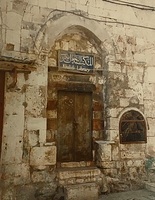 Khalidi Library, Jerusalem
 Colour photograph of the entrance to the Khalidi Library in Jerusalem.
-
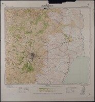 Map of Jerusalem - Regional (1:100,000), Surveyed 1934, Published 1939
 Map of Jerusalem - Regional (1:100,000), Surveyed 1934, Published 1939. 1:100,000 Series, Sheet 8. Compiled, Drawn & Printed under the direction of F.J. Salmon, Commissioner for Lands & Surveys, Palestine, 1934. Surveyed by plane-table 1933-34. Contours from Military Surveys 1918 & Survey of Palestine 1934. Photo-Zincography by Survey of Palestine. Roads revised to September 1939.
-
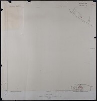 Map of Jerusalem (1:1250), District 165-130. Sub-District 7. A., Surveyed 1937, Published 1937
 Map of Jerusalem (1:1250), District 165-130. Sub-District 7. A., Surveyed 1937, Published 1937. Undertaken by Survey of Palestine.
-
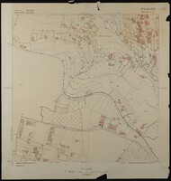 Map of Jerusalem (1:1250), District 165-130. Sub-District 7. B., Surveyed 1936, Published 1937
 Map of Jerusalem (1:1250), District 165-130. Sub-District 7. B., Surveyed 1936, Published 1937. Undertaken by Survey of Palestine.
-
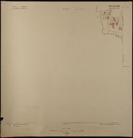 Map of Jerusalem (1:1250), District 165-130. Sub-District 7. C., Surveyed 1936, Published 1937
 Map of Jerusalem (1:1250), District 165-130. Sub-District 7. C., Surveyed 1936, Published 1937. Undertaken by Survey of Palestine.
-
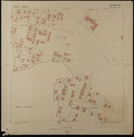 Map of Jerusalem (1:1250), District 165-130. Sub-District 7. D., Surveyed 1936, Published 1937
 Map of Jerusalem (1:1250), District 165-130. Sub-District 7. D., Surveyed 1936, Published 1937. Undertaken by Survey of Palestine.
-
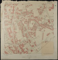 Map of Jerusalem (1:1250), District 170-130. Sub-District 10. A., Surveyed 1936, Published 1938
 Map of Jerusalem (1:1250), District 170-130. Sub-District 10. A., Surveyed 1936, Published 1938. Undertaken by Survey of Palestine.
-
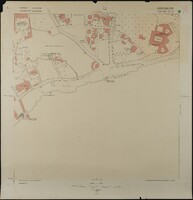 Map of Jerusalem (1:1250), District 170-130. Sub-District 10. B., Surveyed 1935, Published 1938
 Map of Jerusalem (1:1250), District 170-130. Sub-District 10. B., Surveyed 1935, Published 1938. Undertaken by Survey of Palestine.
-
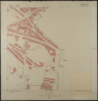 Map of Jerusalem (1:1250), District 170-130. Sub-District 10. C., Surveyed 1935, Published 1938
 Map of Jerusalem (1:1250), District 170-130. Sub-District 10. C., Surveyed 1935, Published 1938. Undertaken by Survey of Palestine.
-
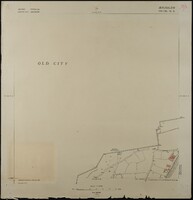 Map of Jerusalem (1:1250), District 170-130. Sub-District 10. D., Surveyed 1935, Published 1938
 Map of Jerusalem (1:1250), District 170-130. Sub-District 10. D., Surveyed 1935, Published 1938. Undertaken by Survey of Palestine.
-
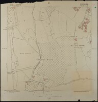 Map of Jerusalem (1:1250), District 170-130. Sub-District 11. A., Surveyed 1936, Published 1938
 Map of Jerusalem (1:1250), District 170-130. Sub-District 11. A., Surveyed 1936, Published 1938. Undertaken by Survey of Palestine.
-
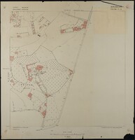 Map of Jerusalem (1:1250), District 170-130. Sub-District 11. B., Surveyed 1936, Published 1938
 Map of Jerusalem (1:1250), District 170-130. Sub-District 11. B., Surveyed 1936, Published 1938. Undertaken by Survey of Palestine.
-
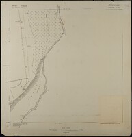 Map of Jerusalem (1:1250), District 170-130. Sub-District 11. C., Surveyed 1936, Published 1938
 Map of Jerusalem (1:1250), District 170-130. Sub-District 11. C., Surveyed 1936, Published 1938. Undertaken by Survey of Palestine.
-
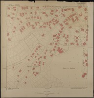 Map of Jerusalem (1:1250), District 170-130. Sub-District 13. A., Surveyed 1935, Published 1937
 Map of Jerusalem (1:1250), District 170-130. Sub-District 13. A., Surveyed 1935, Published 1937. Undertaken by Survey of Palestine.
-
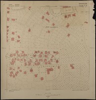 Map of Jerusalem (1:1250), District 170-130. Sub-District 13. B., Surveyed 1935, Published 1937
 Map of Jerusalem (1:1250), District 170-130. Sub-District 13. B., Surveyed 1935, Published 1937. Undertaken by Survey of Palestine.
 General Monthly Bulletin of the Statistics of Palestine, Vol. I, No. 1 (July, 1936)
  General Monthly Bulletin of the Statistics of Palestine, Vol. I, No. 3 (September, 1936)
  General Monthly Bulletin of the Statistics of Palestine, Vol. I, No. 6 (December, 1936)
  General Monthly Bulletin of the Statistics of Palestine, Vol. I, Nos. 4 and 5 (October - November 1936)
  General Union of Palestine Students - UK A document issued by the UK branch of the General Union of Palestine Students, that refers to support for the PFLOAG and other causes
 Guide to Israel's Holiday Forests 32-page booklet, titled in Hebrew 'Madrikh karta le-yaʻarot ha-nofesh shel Yiśraʼel' [Guide to Israel's Holiday Forests ] containing forty maps of recreational forest walks and leisure sites. Published by the Agaf fa-Hasbarah [Information Department) of the Jewish National Fund.
 High Adventure Ministries mobile broadcasting station, Palestine, ca.1979-84. Black-and-white photograph of a large lorry parked in Palestine, with 'HBN High Adventure Broadcasting Network. Star of Hope Television' printed on the side, beneath the Biblical quotation "'In this Place will I Give Peace': Free Lebanon." High Adventure Ministries was founded by George Otis in the early 1970s, and later included a 'Voice of Hope' radio station and 'Star of Hope' television channel, working closely with the IDF, Saad Haddad and the Free Lebanon/South Lebanon Army, a Christian militia group operating in the Israeli-supported 'State of Free Lebanon.'
 Israeli Land and Settlement Policies
  Jerusalem Street Map, 1968. Jerusalem Street Map, Compiled, Drawn & Printed by Survey of Israel, December 1968.
 Jerusalem, The Old City, 1:2500. 1975. Jerusalem, The Old City, 1:2500, First Edition prepared by F.J.Salmon, 1936. Revised and printed by the Survey of Israel, 1975.
 Khalidi Library, Jerusalem Colour photograph of the entrance to the Khalidi Library in Jerusalem.
 Map of Jerusalem - Regional (1:100,000), Surveyed 1934, Published 1939 Map of Jerusalem - Regional (1:100,000), Surveyed 1934, Published 1939. 1:100,000 Series, Sheet 8. Compiled, Drawn & Printed under the direction of F.J. Salmon, Commissioner for Lands & Surveys, Palestine, 1934. Surveyed by plane-table 1933-34. Contours from Military Surveys 1918 & Survey of Palestine 1934. Photo-Zincography by Survey of Palestine. Roads revised to September 1939.
 Map of Jerusalem (1:1250), District 165-130. Sub-District 7. A., Surveyed 1937, Published 1937 Map of Jerusalem (1:1250), District 165-130. Sub-District 7. A., Surveyed 1937, Published 1937. Undertaken by Survey of Palestine.
 Map of Jerusalem (1:1250), District 165-130. Sub-District 7. B., Surveyed 1936, Published 1937 Map of Jerusalem (1:1250), District 165-130. Sub-District 7. B., Surveyed 1936, Published 1937. Undertaken by Survey of Palestine.
 Map of Jerusalem (1:1250), District 165-130. Sub-District 7. C., Surveyed 1936, Published 1937 Map of Jerusalem (1:1250), District 165-130. Sub-District 7. C., Surveyed 1936, Published 1937. Undertaken by Survey of Palestine.
 Map of Jerusalem (1:1250), District 165-130. Sub-District 7. D., Surveyed 1936, Published 1937 Map of Jerusalem (1:1250), District 165-130. Sub-District 7. D., Surveyed 1936, Published 1937. Undertaken by Survey of Palestine.
 Map of Jerusalem (1:1250), District 170-130. Sub-District 10. A., Surveyed 1936, Published 1938 Map of Jerusalem (1:1250), District 170-130. Sub-District 10. A., Surveyed 1936, Published 1938. Undertaken by Survey of Palestine.
 Map of Jerusalem (1:1250), District 170-130. Sub-District 10. B., Surveyed 1935, Published 1938 Map of Jerusalem (1:1250), District 170-130. Sub-District 10. B., Surveyed 1935, Published 1938. Undertaken by Survey of Palestine.
 Map of Jerusalem (1:1250), District 170-130. Sub-District 10. C., Surveyed 1935, Published 1938 Map of Jerusalem (1:1250), District 170-130. Sub-District 10. C., Surveyed 1935, Published 1938. Undertaken by Survey of Palestine.
 Map of Jerusalem (1:1250), District 170-130. Sub-District 10. D., Surveyed 1935, Published 1938 Map of Jerusalem (1:1250), District 170-130. Sub-District 10. D., Surveyed 1935, Published 1938. Undertaken by Survey of Palestine.
 Map of Jerusalem (1:1250), District 170-130. Sub-District 11. A., Surveyed 1936, Published 1938 Map of Jerusalem (1:1250), District 170-130. Sub-District 11. A., Surveyed 1936, Published 1938. Undertaken by Survey of Palestine.
 Map of Jerusalem (1:1250), District 170-130. Sub-District 11. B., Surveyed 1936, Published 1938 Map of Jerusalem (1:1250), District 170-130. Sub-District 11. B., Surveyed 1936, Published 1938. Undertaken by Survey of Palestine.
 Map of Jerusalem (1:1250), District 170-130. Sub-District 11. C., Surveyed 1936, Published 1938 Map of Jerusalem (1:1250), District 170-130. Sub-District 11. C., Surveyed 1936, Published 1938. Undertaken by Survey of Palestine.
 Map of Jerusalem (1:1250), District 170-130. Sub-District 13. A., Surveyed 1935, Published 1937 Map of Jerusalem (1:1250), District 170-130. Sub-District 13. A., Surveyed 1935, Published 1937. Undertaken by Survey of Palestine.
 Map of Jerusalem (1:1250), District 170-130. Sub-District 13. B., Surveyed 1935, Published 1937 Map of Jerusalem (1:1250), District 170-130. Sub-District 13. B., Surveyed 1935, Published 1937. Undertaken by Survey of Palestine.