Skip to main content
العربية
English
کوردی
ئەرشیفی دیجیتاڵی ڕۆژهەڵاتی ناوەڕاست
بابەتەکان
نەخشە
کۆمەڵە بابەتەکاند
Search
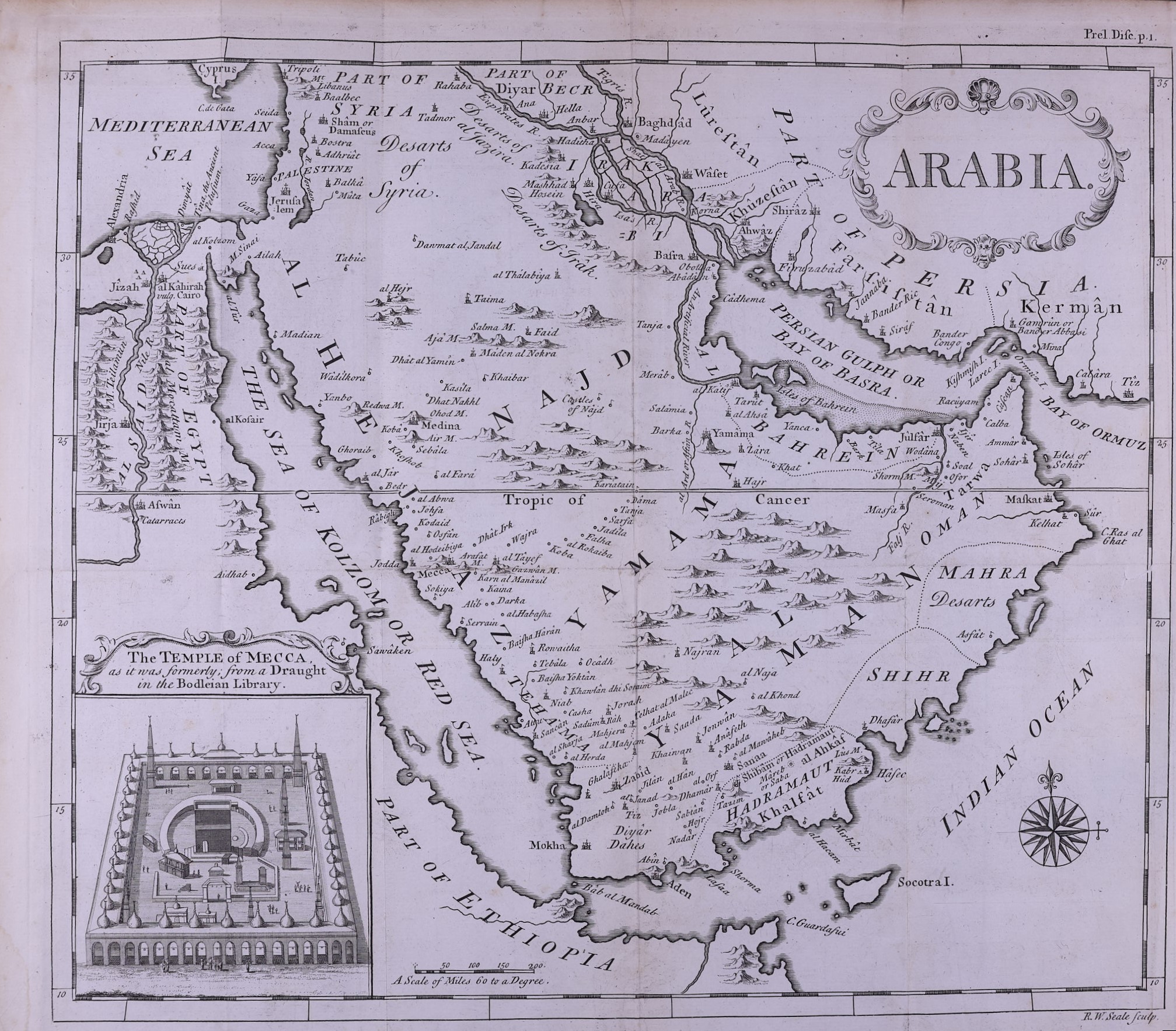
18th century map of Arabia
Item
Description
Spatial Coverage
Subject
Creator
Richard William Seale
Identifier
Reserve Collection 297.122 SAL
Resource class
Image
Item sets
History of the Gulf
Islamic Studies
18th century map of Arabia