-
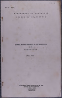 النشرة الشهرية العامة لإحصاءات فلسطين، المجلد ١، العدد ١ (يوليو ١٩٣٦)
-
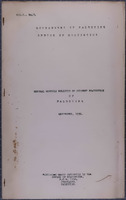 النشرة الشهرية العامة للإحصاءات الجارية في فلسطين، المجلد ١، العدد ٣ (سِبْتَمْبَر ١٩٣٦)
-
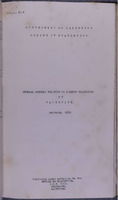 النشرة الشهرية العامة للإحصاءات الجارية في فلسطين، المجلد ١، العدد ٦ (دِيسَمْبَر ١٩٣٦)
-
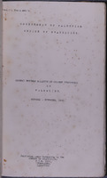 النشرة الشهرية العامة للإحصاءات الجارية في فلسطين، المجلد ١، الأعداد ٤ و ٥ (أُكْتُوبَر - نُوفَمْبَر ١٩٣٦)
-
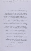 General Union of Palestine Students - UK
 وثيقة صادرة عن الاتحاد العام لطلبة فلسطين (المملكة المتحدة) يشير إلى دعم الجبهة وحركات التحرير الأخرى
-
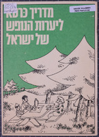 دليل غابات العطلات في إسرائيل
 كتيب مكون من ٣٢ صفحة يحتوي على خرائط للمشي في الغابات في إسرائيل، صادر عن إدارة المعلومات التابعة للصندوق القومي اليهودي
-
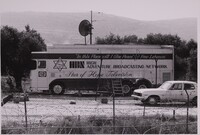 High Adventure Ministries mobile broadcasting station, Palestine, ca.1979-84.
 Black-and-white photograph of a large lorry parked in Palestine, with 'HBN High Adventure Broadcasting Network. Star of Hope Television' printed on the side, beneath the Biblical quotation "'In this Place will I Give Peace': Free Lebanon." High Adventure Ministries was founded by George Otis in the early 1970s, and later included a 'Voice of Hope' radio station and 'Star of Hope' television channel, working closely with the IDF, Saad Haddad and the Free Lebanon/South Lebanon Army, a Christian militia group operating in the Israeli-supported 'State of Free Lebanon.'
-
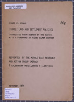 سياسات الاستيطان الإسرائيلية
-
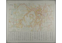 خريطة شارع القدس (١٩٦٨)
 خريطة شارع القدس, تم تجميعه ورسمه وطباعته بواسطة هيئة المساحة الإسرائيلية، ديسمبر١٩٦٨
-
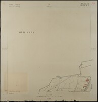
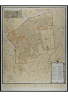 خريطة البلدة القديمة (القدس)
 Jerusalem, The Old City, 1:2500, First Edition prepared by F.J.Salmon, 1936. Revised and printed by the Survey of Israel, 1975.
-
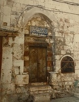 المكتبة الخالدية
 Colour photograph of the entrance to the Khalidi Library in Jerusalem.
-
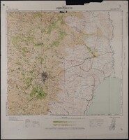 Map of Jerusalem - Regional (1:100,000), Surveyed 1934, Published 1939
 Map of Jerusalem - Regional (1:100,000), Surveyed 1934, Published 1939. 1:100,000 Series, Sheet 8. Compiled, Drawn & Printed under the direction of F.J. Salmon, Commissioner for Lands & Surveys, Palestine, 1934. Surveyed by plane-table 1933-34. Contours from Military Surveys 1918 & Survey of Palestine 1934. Photo-Zincography by Survey of Palestine. Roads revised to September 1939.
-
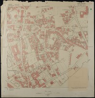
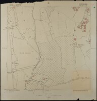
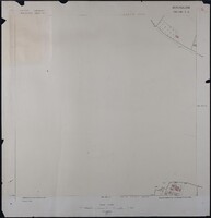 Map of Jerusalem (1:1250), District 165-130. Sub-District 7. A., Surveyed 1937, Published 1937
 Map of Jerusalem (1:1250), District 165-130. Sub-District 7. A., Surveyed 1937, Published 1937. Undertaken by Survey of Palestine.
-
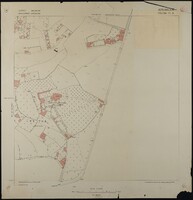
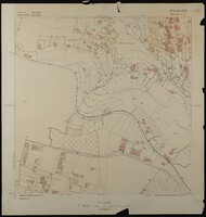 Map of Jerusalem (1:1250), District 165-130. Sub-District 7. B., Surveyed 1936, Published 1937
 Map of Jerusalem (1:1250), District 165-130. Sub-District 7. B., Surveyed 1936, Published 1937. Undertaken by Survey of Palestine.
-
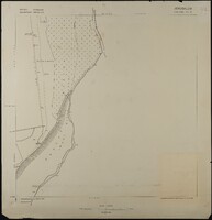
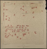
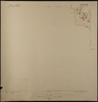 Map of Jerusalem (1:1250), District 165-130. Sub-District 7. C., Surveyed 1936, Published 1937
 Map of Jerusalem (1:1250), District 165-130. Sub-District 7. C., Surveyed 1936, Published 1937. Undertaken by Survey of Palestine.
-
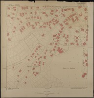
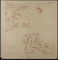 Map of Jerusalem (1:1250), District 165-130. Sub-District 7. D., Surveyed 1936, Published 1937
 Map of Jerusalem (1:1250), District 165-130. Sub-District 7. D., Surveyed 1936, Published 1937. Undertaken by Survey of Palestine.
-
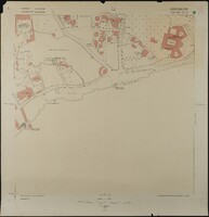
 Map of Jerusalem (1:1250), District 170-130. Sub-District 10. A., Surveyed 1936, Published 1938
 Map of Jerusalem (1:1250), District 170-130. Sub-District 10. A., Surveyed 1936, Published 1938. Undertaken by Survey of Palestine.
-
 Map of Jerusalem (1:1250), District 170-130. Sub-District 10. B., Surveyed 1935, Published 1938
 Map of Jerusalem (1:1250), District 170-130. Sub-District 10. B., Surveyed 1935, Published 1938. Undertaken by Survey of Palestine.
-
 Map of Jerusalem (1:1250), District 170-130. Sub-District 10. C., Surveyed 1935, Published 1938
 Map of Jerusalem (1:1250), District 170-130. Sub-District 10. C., Surveyed 1935, Published 1938. Undertaken by Survey of Palestine.
-
 Map of Jerusalem (1:1250), District 170-130. Sub-District 10. D., Surveyed 1935, Published 1938
 Map of Jerusalem (1:1250), District 170-130. Sub-District 10. D., Surveyed 1935, Published 1938. Undertaken by Survey of Palestine.
-
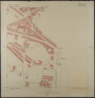
 Map of Jerusalem (1:1250), District 170-130. Sub-District 11. A., Surveyed 1936, Published 1938
 Map of Jerusalem (1:1250), District 170-130. Sub-District 11. A., Surveyed 1936, Published 1938. Undertaken by Survey of Palestine.
-
 Map of Jerusalem (1:1250), District 170-130. Sub-District 11. B., Surveyed 1936, Published 1938
 Map of Jerusalem (1:1250), District 170-130. Sub-District 11. B., Surveyed 1936, Published 1938. Undertaken by Survey of Palestine.
-
 Map of Jerusalem (1:1250), District 170-130. Sub-District 11. C., Surveyed 1936, Published 1938
 Map of Jerusalem (1:1250), District 170-130. Sub-District 11. C., Surveyed 1936, Published 1938. Undertaken by Survey of Palestine.
-
 Map of Jerusalem (1:1250), District 170-130. Sub-District 13. A., Surveyed 1935, Published 1937
 Map of Jerusalem (1:1250), District 170-130. Sub-District 13. A., Surveyed 1935, Published 1937. Undertaken by Survey of Palestine.
-
 Map of Jerusalem (1:1250), District 170-130. Sub-District 13. B., Surveyed 1935, Published 1937
 Map of Jerusalem (1:1250), District 170-130. Sub-District 13. B., Surveyed 1935, Published 1937. Undertaken by Survey of Palestine.