-
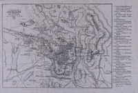 Cook's Plan of Jerusalem and Environs. Corrected to date by Rev. J.E. Hanauer, Jerusalem, 1906.
 Map of Jerusalem and the surrounding region, from 'Cook's Tourist's Handbook for Palestine and Syria' (London: Thomas Cook & Son, 1911), revised by Rev. James Edward Hanauer (1850-1938), Canon of St. George's Cathedral in Jerusalem.
-
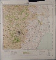 Map of Jerusalem - Regional (1:100,000), Surveyed 1934, Published 1939
 Map of Jerusalem - Regional (1:100,000), Surveyed 1934, Published 1939. 1:100,000 Series, Sheet 8. Compiled, Drawn & Printed under the direction of F.J. Salmon, Commissioner for Lands & Surveys, Palestine, 1934. Surveyed by plane-table 1933-34. Contours from Military Surveys 1918 & Survey of Palestine 1934. Photo-Zincography by Survey of Palestine. Roads revised to September 1939.
-
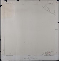 Map of Jerusalem (1:1250), District 165-130. Sub-District 7. A., Surveyed 1937, Published 1937
 Map of Jerusalem (1:1250), District 165-130. Sub-District 7. A., Surveyed 1937, Published 1937. Undertaken by Survey of Palestine.
-
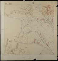 Map of Jerusalem (1:1250), District 165-130. Sub-District 7. B., Surveyed 1936, Published 1937
 Map of Jerusalem (1:1250), District 165-130. Sub-District 7. B., Surveyed 1936, Published 1937. Undertaken by Survey of Palestine.
-
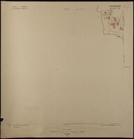 Map of Jerusalem (1:1250), District 165-130. Sub-District 7. C., Surveyed 1936, Published 1937
 Map of Jerusalem (1:1250), District 165-130. Sub-District 7. C., Surveyed 1936, Published 1937. Undertaken by Survey of Palestine.
-
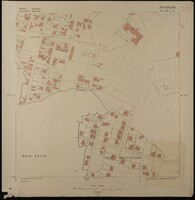 Map of Jerusalem (1:1250), District 165-130. Sub-District 7. D., Surveyed 1936, Published 1937
 Map of Jerusalem (1:1250), District 165-130. Sub-District 7. D., Surveyed 1936, Published 1937. Undertaken by Survey of Palestine.
-
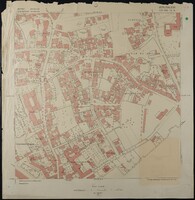 Map of Jerusalem (1:1250), District 170-130. Sub-District 10. A., Surveyed 1936, Published 1938
 Map of Jerusalem (1:1250), District 170-130. Sub-District 10. A., Surveyed 1936, Published 1938. Undertaken by Survey of Palestine.
-
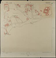 Map of Jerusalem (1:1250), District 170-130. Sub-District 10. B., Surveyed 1935, Published 1938
 Map of Jerusalem (1:1250), District 170-130. Sub-District 10. B., Surveyed 1935, Published 1938. Undertaken by Survey of Palestine.
-
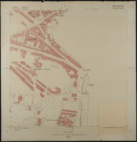 Map of Jerusalem (1:1250), District 170-130. Sub-District 10. C., Surveyed 1935, Published 1938
 Map of Jerusalem (1:1250), District 170-130. Sub-District 10. C., Surveyed 1935, Published 1938. Undertaken by Survey of Palestine.
-
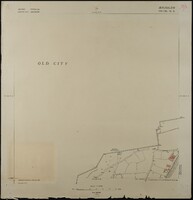 Map of Jerusalem (1:1250), District 170-130. Sub-District 10. D., Surveyed 1935, Published 1938
 Map of Jerusalem (1:1250), District 170-130. Sub-District 10. D., Surveyed 1935, Published 1938. Undertaken by Survey of Palestine.
-
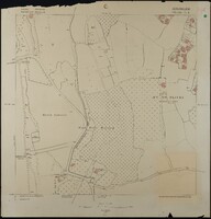 Map of Jerusalem (1:1250), District 170-130. Sub-District 11. A., Surveyed 1936, Published 1938
 Map of Jerusalem (1:1250), District 170-130. Sub-District 11. A., Surveyed 1936, Published 1938. Undertaken by Survey of Palestine.
-
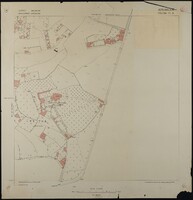 Map of Jerusalem (1:1250), District 170-130. Sub-District 11. B., Surveyed 1936, Published 1938
 Map of Jerusalem (1:1250), District 170-130. Sub-District 11. B., Surveyed 1936, Published 1938. Undertaken by Survey of Palestine.
-
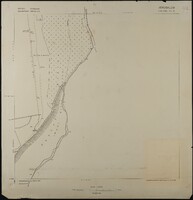 Map of Jerusalem (1:1250), District 170-130. Sub-District 11. C., Surveyed 1936, Published 1938
 Map of Jerusalem (1:1250), District 170-130. Sub-District 11. C., Surveyed 1936, Published 1938. Undertaken by Survey of Palestine.
-
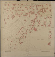 Map of Jerusalem (1:1250), District 170-130. Sub-District 13. A., Surveyed 1935, Published 1937
 Map of Jerusalem (1:1250), District 170-130. Sub-District 13. A., Surveyed 1935, Published 1937. Undertaken by Survey of Palestine.
-
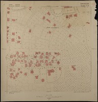 Map of Jerusalem (1:1250), District 170-130. Sub-District 13. B., Surveyed 1935, Published 1937
 Map of Jerusalem (1:1250), District 170-130. Sub-District 13. B., Surveyed 1935, Published 1937. Undertaken by Survey of Palestine.
-
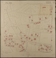 Map of Jerusalem (1:1250), District 170-130. Sub-District 13. C., Surveyed 1935, Published 1937
 Map of Jerusalem (1:1250), District 170-130. Sub-District 13. C., Surveyed 1935, Published 1937 . Undertaken by Survey of Palestine.
-
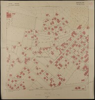 Map of Jerusalem (1:1250), District 170-130. Sub-District 13. D., Surveyed 1935, Published 1937
 Map of Jerusalem (1:1250), District 170-130. Sub-District 13. D., Surveyed 1935, Published 1937. Undertaken by Survey of Palestine.
-
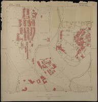 Map of Jerusalem (1:1250), District 170-130. Sub-District 14. A., Surveyed 1935, Published 1937
 Map of Jerusalem (1:1250), District 170-130. Sub-District 14. A., Surveyed 1935, Published 1937. Undertaken by Survey of Palestine.
-
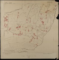 Map of Jerusalem (1:1250), District 170-130. Sub-District 14. B., Surveyed 1935, Published 1937
 Map of Jerusalem (1:1250), District 170-130. Sub-District 14. B., Surveyed 1935, Published 1937. Undertaken by Survey of Palestine.
-
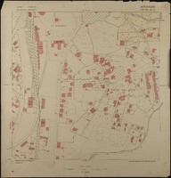 Map of Jerusalem (1:1250), District 170-130. Sub-District 14. C., Surveyed 1935, Published 1937
 Map of Jerusalem (1:1250), District 170-130. Sub-District 14. C., Surveyed 1935, Published 1937. Undertaken by Survey of Palestine.
-
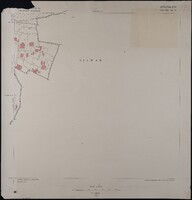 Map of Jerusalem (1:1250), District 170-130. Sub-District 14. D., Surveyed 1935, Published 1937
 Map of Jerusalem (1:1250), District 170-130. Sub-District 14. D., Surveyed 1935, Published 1937. Undertaken by Survey of Palestine.
-
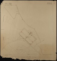 Map of Jerusalem (1:1250), District 170-130. Sub-District 3. C., Surveyed 1936, Published 1938
 Map of Jerusalem (1:1250), District 170-130. Sub-District 3. C., Surveyed 1936, Published 1938. Undertaken by Survey of Palestine.
-
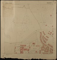 Map of Jerusalem (1:1250), District 170-130. Sub-District 5. A., Surveyed 1936, Published 1938
 Map of Jerusalem (1:1250), District 170-130. Sub-District 5. A., Surveyed 1936, Published 1938. Undertaken by Survey of Palestine.
-
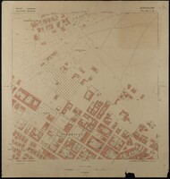 Map of Jerusalem (1:1250), District 170-130. Sub-District 5. B., Surveyed 1936, Published 1938
 Map of Jerusalem (1:1250), District 170-130. Sub-District 5. B., Surveyed 1936, Published 1938. Undertaken by Survey of Palestine.
-
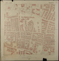 Map of Jerusalem (1:1250), District 170-130. Sub-District 5. C., Surveyed 1936, Published 1938
 Map of Jerusalem (1:1250), District 170-130. Sub-District 5. C., Surveyed 1936, Published 1938. Undertaken by Survey of Palestine.
 Cook's Plan of Jerusalem and Environs. Corrected to date by Rev. J.E. Hanauer, Jerusalem, 1906. Map of Jerusalem and the surrounding region, from 'Cook's Tourist's Handbook for Palestine and Syria' (London: Thomas Cook & Son, 1911), revised by Rev. James Edward Hanauer (1850-1938), Canon of St. George's Cathedral in Jerusalem.
 Map of Jerusalem - Regional (1:100,000), Surveyed 1934, Published 1939 Map of Jerusalem - Regional (1:100,000), Surveyed 1934, Published 1939. 1:100,000 Series, Sheet 8. Compiled, Drawn & Printed under the direction of F.J. Salmon, Commissioner for Lands & Surveys, Palestine, 1934. Surveyed by plane-table 1933-34. Contours from Military Surveys 1918 & Survey of Palestine 1934. Photo-Zincography by Survey of Palestine. Roads revised to September 1939.
 Map of Jerusalem (1:1250), District 165-130. Sub-District 7. A., Surveyed 1937, Published 1937 Map of Jerusalem (1:1250), District 165-130. Sub-District 7. A., Surveyed 1937, Published 1937. Undertaken by Survey of Palestine.
 Map of Jerusalem (1:1250), District 165-130. Sub-District 7. B., Surveyed 1936, Published 1937 Map of Jerusalem (1:1250), District 165-130. Sub-District 7. B., Surveyed 1936, Published 1937. Undertaken by Survey of Palestine.
 Map of Jerusalem (1:1250), District 165-130. Sub-District 7. C., Surveyed 1936, Published 1937 Map of Jerusalem (1:1250), District 165-130. Sub-District 7. C., Surveyed 1936, Published 1937. Undertaken by Survey of Palestine.
 Map of Jerusalem (1:1250), District 165-130. Sub-District 7. D., Surveyed 1936, Published 1937 Map of Jerusalem (1:1250), District 165-130. Sub-District 7. D., Surveyed 1936, Published 1937. Undertaken by Survey of Palestine.
 Map of Jerusalem (1:1250), District 170-130. Sub-District 10. A., Surveyed 1936, Published 1938 Map of Jerusalem (1:1250), District 170-130. Sub-District 10. A., Surveyed 1936, Published 1938. Undertaken by Survey of Palestine.
 Map of Jerusalem (1:1250), District 170-130. Sub-District 10. B., Surveyed 1935, Published 1938 Map of Jerusalem (1:1250), District 170-130. Sub-District 10. B., Surveyed 1935, Published 1938. Undertaken by Survey of Palestine.
 Map of Jerusalem (1:1250), District 170-130. Sub-District 10. C., Surveyed 1935, Published 1938 Map of Jerusalem (1:1250), District 170-130. Sub-District 10. C., Surveyed 1935, Published 1938. Undertaken by Survey of Palestine.
 Map of Jerusalem (1:1250), District 170-130. Sub-District 10. D., Surveyed 1935, Published 1938 Map of Jerusalem (1:1250), District 170-130. Sub-District 10. D., Surveyed 1935, Published 1938. Undertaken by Survey of Palestine.
 Map of Jerusalem (1:1250), District 170-130. Sub-District 11. A., Surveyed 1936, Published 1938 Map of Jerusalem (1:1250), District 170-130. Sub-District 11. A., Surveyed 1936, Published 1938. Undertaken by Survey of Palestine.
 Map of Jerusalem (1:1250), District 170-130. Sub-District 11. B., Surveyed 1936, Published 1938 Map of Jerusalem (1:1250), District 170-130. Sub-District 11. B., Surveyed 1936, Published 1938. Undertaken by Survey of Palestine.
 Map of Jerusalem (1:1250), District 170-130. Sub-District 11. C., Surveyed 1936, Published 1938 Map of Jerusalem (1:1250), District 170-130. Sub-District 11. C., Surveyed 1936, Published 1938. Undertaken by Survey of Palestine.
 Map of Jerusalem (1:1250), District 170-130. Sub-District 13. A., Surveyed 1935, Published 1937 Map of Jerusalem (1:1250), District 170-130. Sub-District 13. A., Surveyed 1935, Published 1937. Undertaken by Survey of Palestine.
 Map of Jerusalem (1:1250), District 170-130. Sub-District 13. B., Surveyed 1935, Published 1937 Map of Jerusalem (1:1250), District 170-130. Sub-District 13. B., Surveyed 1935, Published 1937. Undertaken by Survey of Palestine.
 Map of Jerusalem (1:1250), District 170-130. Sub-District 13. C., Surveyed 1935, Published 1937 Map of Jerusalem (1:1250), District 170-130. Sub-District 13. C., Surveyed 1935, Published 1937 . Undertaken by Survey of Palestine.
 Map of Jerusalem (1:1250), District 170-130. Sub-District 13. D., Surveyed 1935, Published 1937 Map of Jerusalem (1:1250), District 170-130. Sub-District 13. D., Surveyed 1935, Published 1937. Undertaken by Survey of Palestine.
 Map of Jerusalem (1:1250), District 170-130. Sub-District 14. A., Surveyed 1935, Published 1937 Map of Jerusalem (1:1250), District 170-130. Sub-District 14. A., Surveyed 1935, Published 1937. Undertaken by Survey of Palestine.
 Map of Jerusalem (1:1250), District 170-130. Sub-District 14. B., Surveyed 1935, Published 1937 Map of Jerusalem (1:1250), District 170-130. Sub-District 14. B., Surveyed 1935, Published 1937. Undertaken by Survey of Palestine.
 Map of Jerusalem (1:1250), District 170-130. Sub-District 14. C., Surveyed 1935, Published 1937 Map of Jerusalem (1:1250), District 170-130. Sub-District 14. C., Surveyed 1935, Published 1937. Undertaken by Survey of Palestine.
 Map of Jerusalem (1:1250), District 170-130. Sub-District 14. D., Surveyed 1935, Published 1937 Map of Jerusalem (1:1250), District 170-130. Sub-District 14. D., Surveyed 1935, Published 1937. Undertaken by Survey of Palestine.
 Map of Jerusalem (1:1250), District 170-130. Sub-District 3. C., Surveyed 1936, Published 1938 Map of Jerusalem (1:1250), District 170-130. Sub-District 3. C., Surveyed 1936, Published 1938. Undertaken by Survey of Palestine.
 Map of Jerusalem (1:1250), District 170-130. Sub-District 5. A., Surveyed 1936, Published 1938 Map of Jerusalem (1:1250), District 170-130. Sub-District 5. A., Surveyed 1936, Published 1938. Undertaken by Survey of Palestine.
 Map of Jerusalem (1:1250), District 170-130. Sub-District 5. B., Surveyed 1936, Published 1938 Map of Jerusalem (1:1250), District 170-130. Sub-District 5. B., Surveyed 1936, Published 1938. Undertaken by Survey of Palestine.
 Map of Jerusalem (1:1250), District 170-130. Sub-District 5. C., Surveyed 1936, Published 1938 Map of Jerusalem (1:1250), District 170-130. Sub-District 5. C., Surveyed 1936, Published 1938. Undertaken by Survey of Palestine.