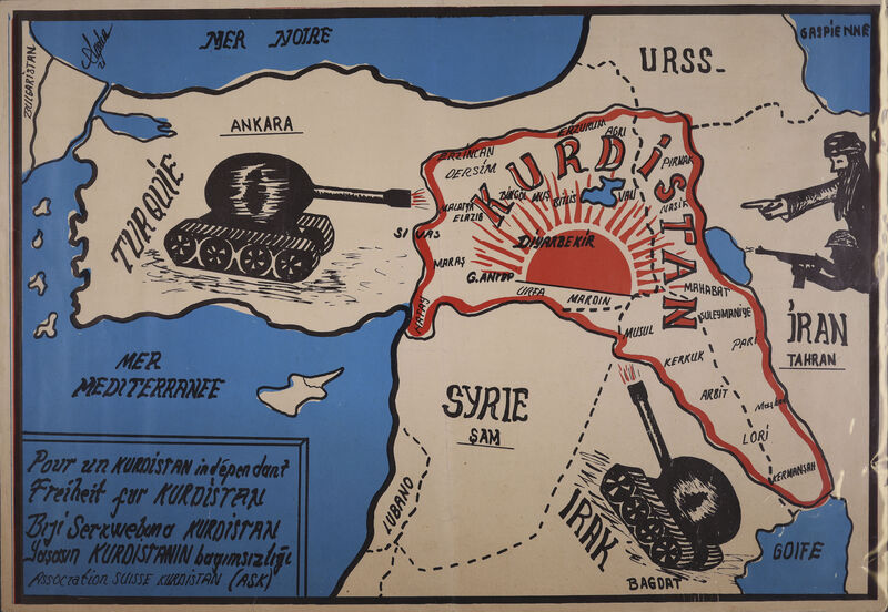
Map of Kurdistan
Item
-
Description
-
Coloured map of Kurdistan, produced by the Association Suisse Kurdistan (ASK) probably in the early 1980s, and showing Kurdistan surrounded by the hostile countries of Iraq, Iran and Turkey, whose threat is symbolised by depictions of tanks and armed soldiers pointing their weapons at the Kurdish territory. Slogans advocating for the liberation of the Kurdish people are printed in French, German, Kurmanji Kurdish and Turkish. The map includes the Turkish province of Hatay (formerly the Syrian sanjak of Alexandretta) on the Mediterranean coast as part of Kurdistan.
-
Spatial Coverage
-
Kurdish lands
-
Subject
-
Kurdistan Map
-
Creator
-
Association Suisse Kurdistan (ASK)
-
Date
-
N.d. [early 1980s?]
-
Identifier
-
EUL MS 483
- Resource class
- Image
