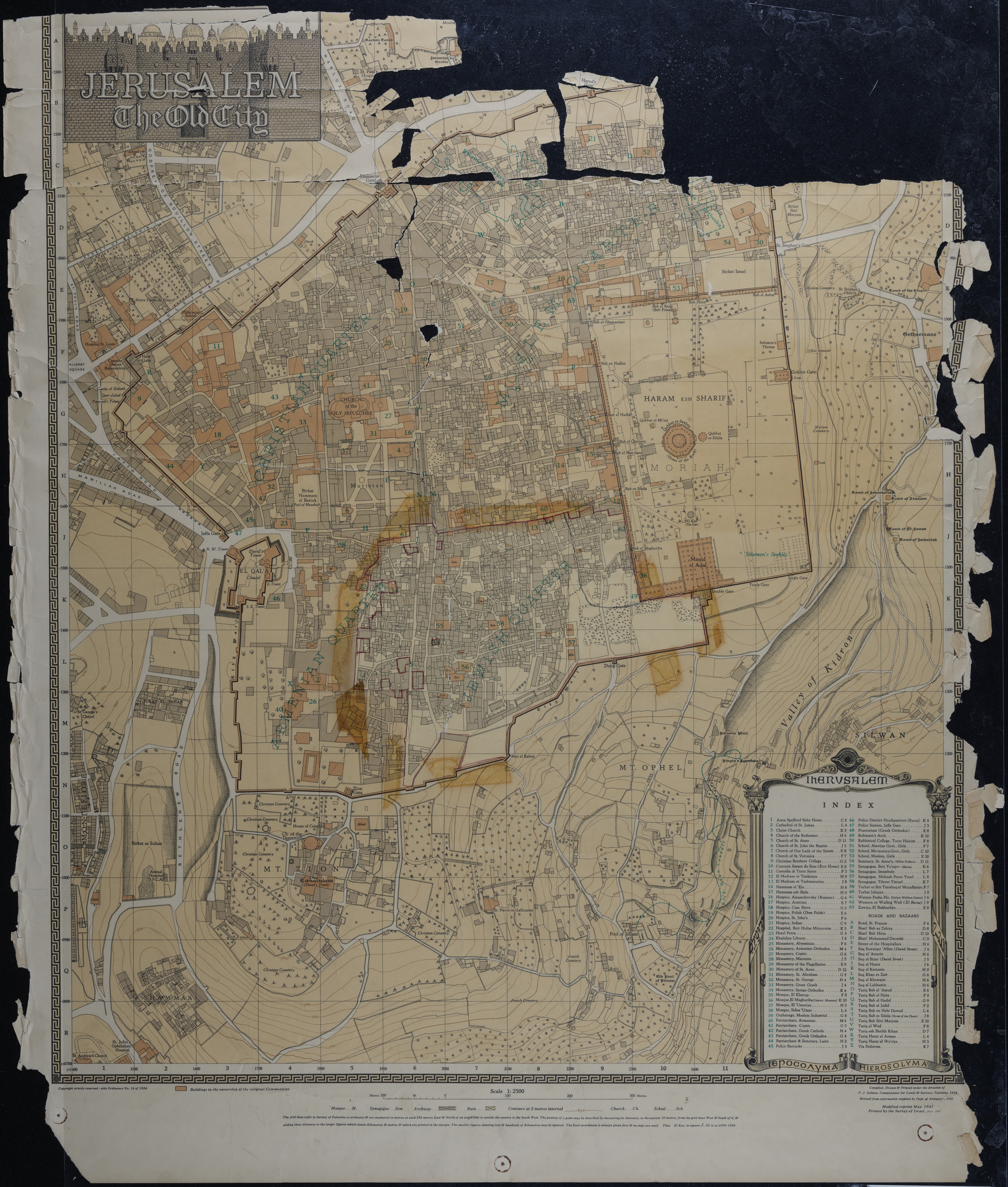
Map of Jerusalem (1:2500); The Old City, Surveyed 1936, Published 1967.
Item
-
Description
-
Map of Jerusalem (1:2500); The Old City, Surveyed 1936, Published 1967. Compiled, Drawn & Printed under the direction of F.J. Salmon, Commissioner for Lands & Surveys, Palestine, 1936. Revised from information supplied by Dept. of Antiquities, 1945. Modified reprint May 1947. Printed by Survey of Israel, June 1967.
-
Spatial Coverage
-
Israel
-
Subject
-
Israel
-
Creator
-
Compiled, Drawn & Printed under the direction of F.J. Salmon, Commissioner for Lands & Surveys, Palestine, 1936. Revised from information supplied by Dept. of Antiquities, 1945. Modified reprint May 1947. Printed by Survey of Israel, June 1967.
-
Date
-
1936
-
1967
-
Identifier
-
EUL MS 478/9
- Resource class
- Image