Skip to main content
العربية
English
کوردی
ئەرشیفی دیجیتاڵی ڕۆژهەڵاتی ناوەڕاست
بابەتەکان
نەخشە
کۆمەڵە بابەتەکاند
Search
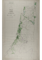
Map of Palestine; Irrigated Areas, 1:250,000. 1955.
Item
1
/
1
Description
Spatial Coverage
Subject
Creator
Date
1955
Identifier
MS 115/41/3
Resource class
Image
Item sets
Palestine
Palestine Maps
+
−
⊡
Streets
Grayscale
Satellite
Terrain
Leaflet
|
©
OpenStreetMap
contributors
Map of Palestine; Irrigated Areas, 1:250,000. 1955.