Maps of Jerusalem (1:1250), Districts 165-130 & 170-130. Surveyed 1935-1937, Published 1937-1938.
Item
-
Description
-
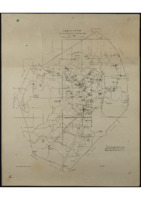
Maps of Jerusalem (1:1250), Districts 165-130 & 170-130. Surveyed 1935-1937, Published 1937-1938. A full PDF containing the 37 maps of Jerusalem which originate from the Palestine survey in the 1930's under British Administration, covering districts 165-130 & 170-130. The maps start with the index and run in numerical order of District, then Sub-District.
-
Spatial Coverage
-
Subject
-
Israel
-
Creator
-
British Administration: Survey of Palestine
-
Date
-
1935
-
1936
-
1937
-
1938
-
Identifier
-
EUL MS 478/9
- Resource class
- Collection